


The Sands of Time

Sand fascinates. It is a symbol of time and transformation. An individual sand grain can be incredibly durable. A grain of mineral quartz sand can be a billion years old. With sand’s fluid movement and shifting shapes of dunes, drifting and flowing, a vast empty unmarked land of sand is a land of mystery. All those tiny grains sparkling underfoot as the wind sends them on bouncing and flying-how did this barren land come to be? And how long will it stay here?
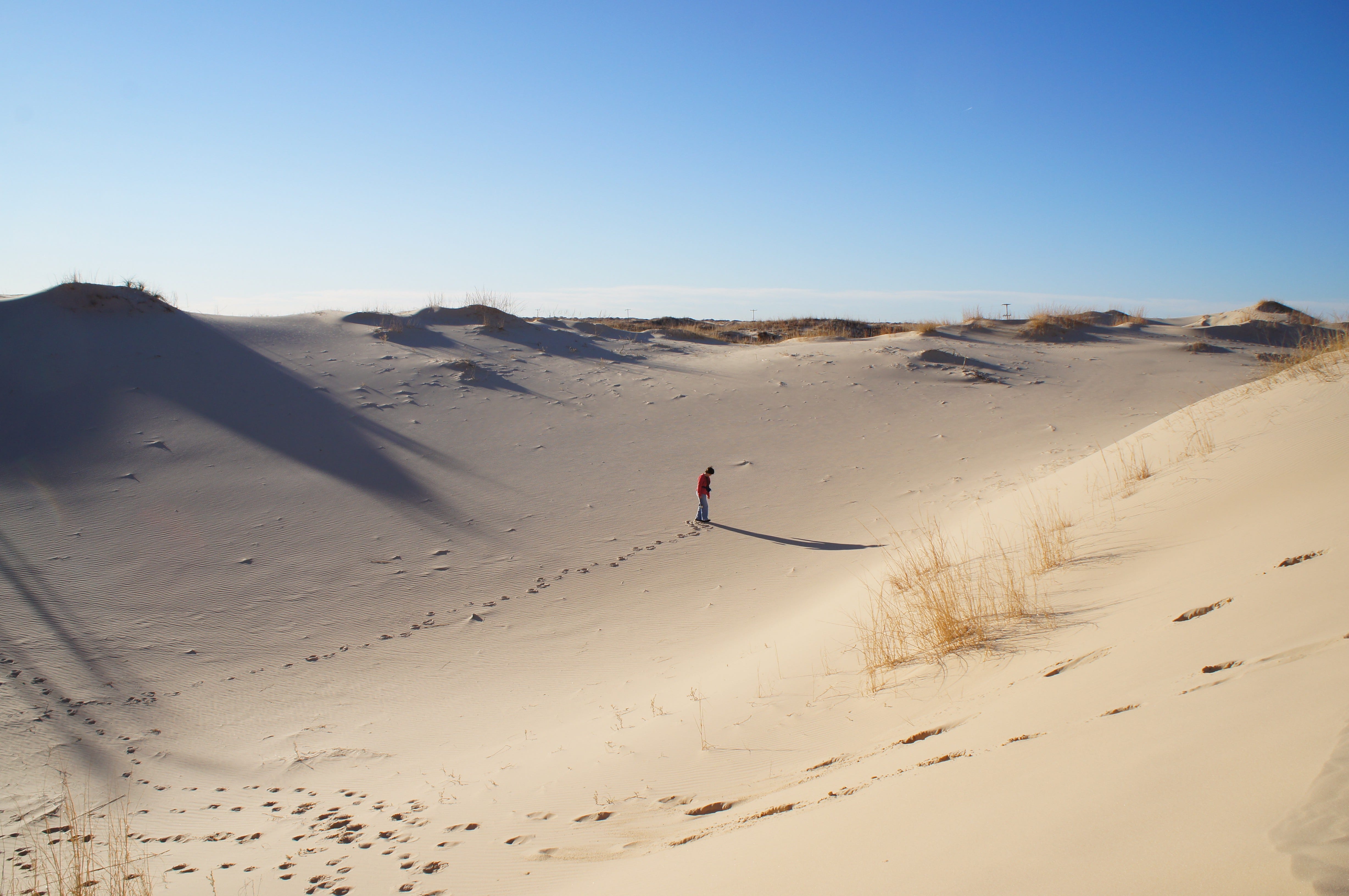
Inland dunes- not on Lake Ontario
It’s very unlikely we would have today’s city skyscrapers, soaring steel bridges and vast concrete ribbons of highway without the essential ingredient of sand. It’s been called a pillar of modern civilization. Yet its transient landscape as it comes and goes is a sharp contrast, no pun intended, from that of solid ground. (Sharp sand from rivers has angular grains unlike wind rounded sand grains and is required to make strong durable concrete).
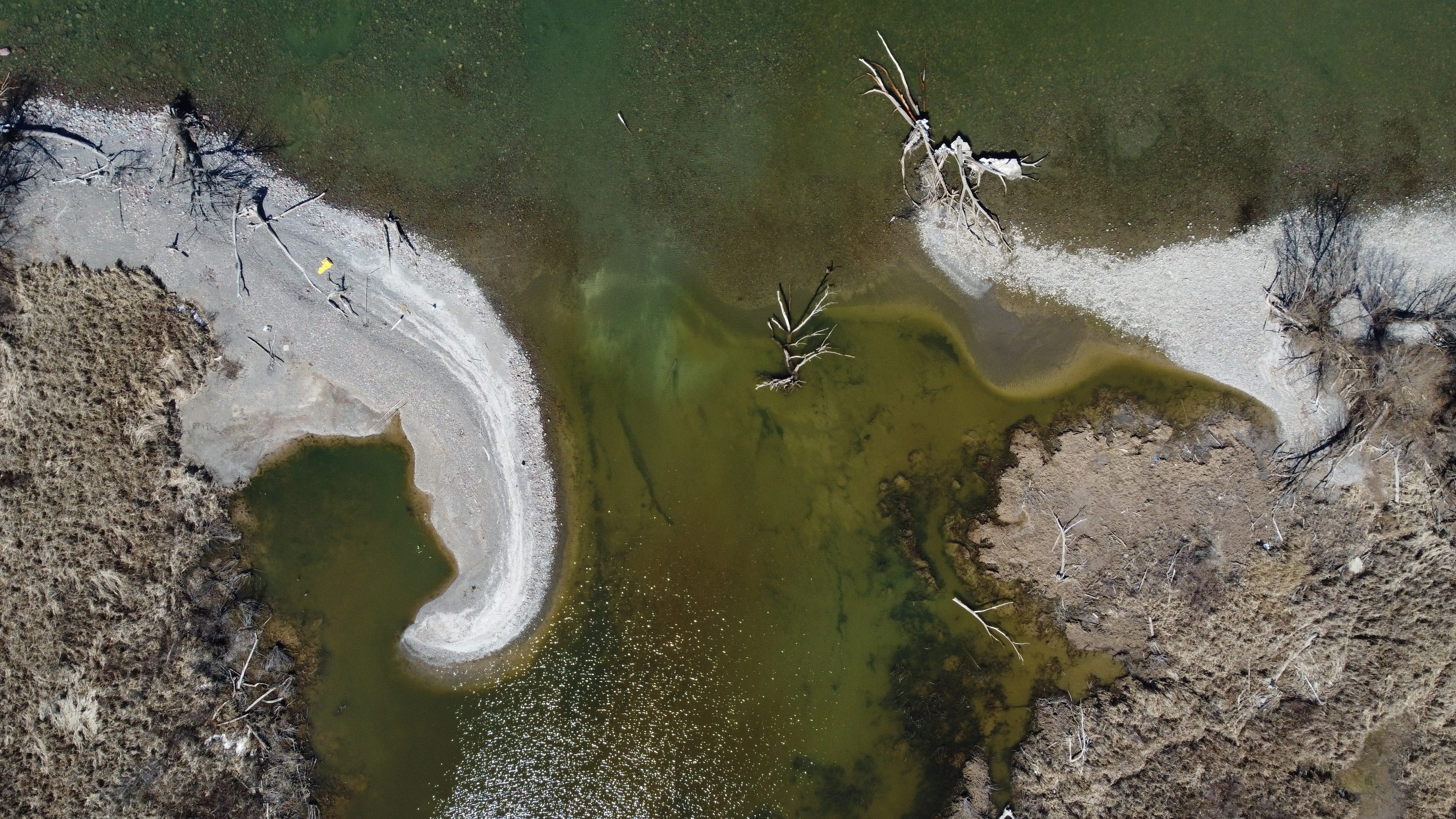
When I first began exploring Lake Ontario with my 23 foot sloop Ariel in 1980 I soon discovered several areas of the lake’s coast that looked very different from my childhood swim beach. That neighborhood stretch of shoreline in Wayne County had been made up of cobbles and pebbles. But the shoreline near Irondequoit Bay, (see photo below)

the lake’s east end, the west side of Prince Edward County and the island archipelago of Toronto were made of large areas of sand. Here I saw shores like those of Cape Cod. Where had the Lake’s sand come from and how did it all collect at these particular places?
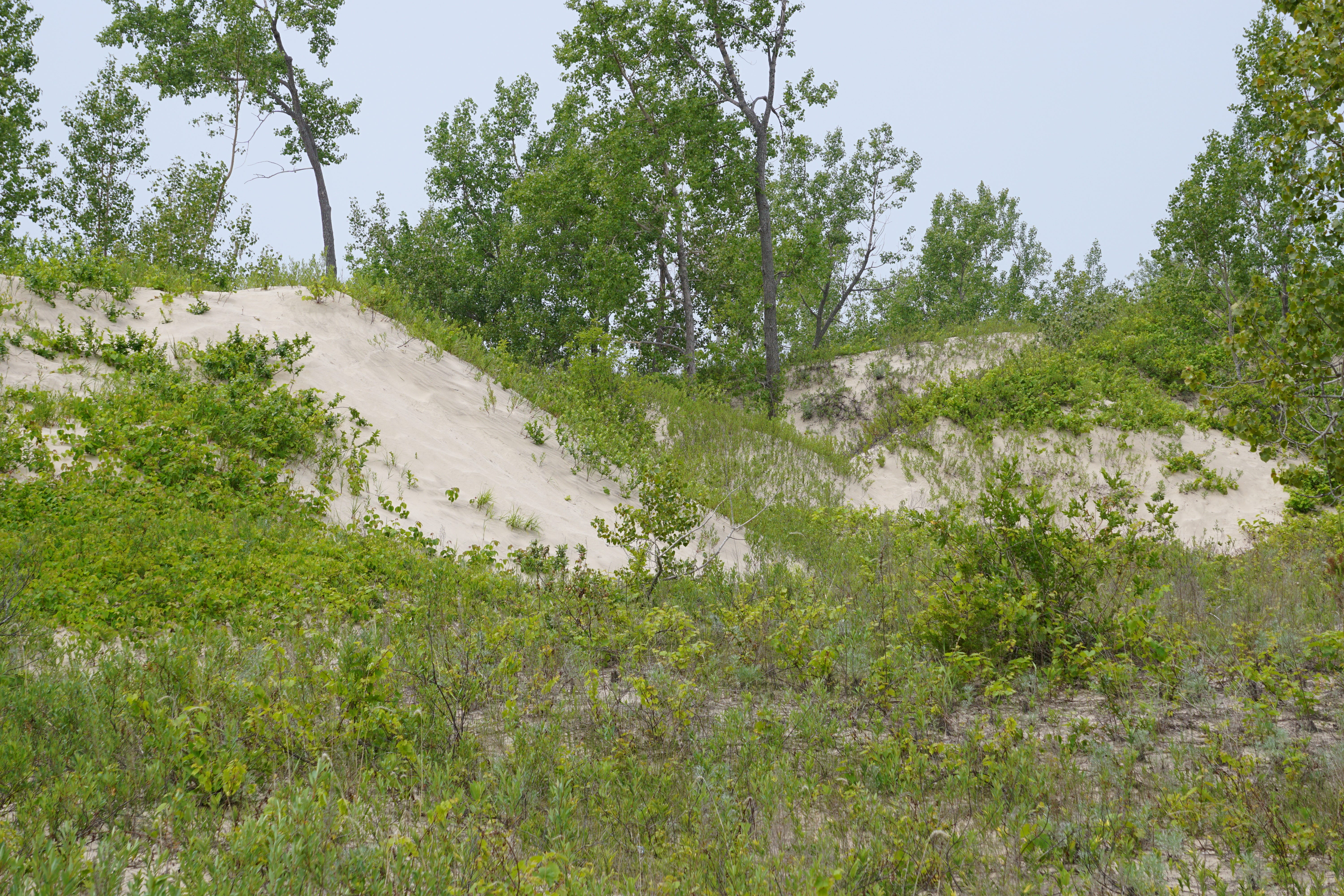
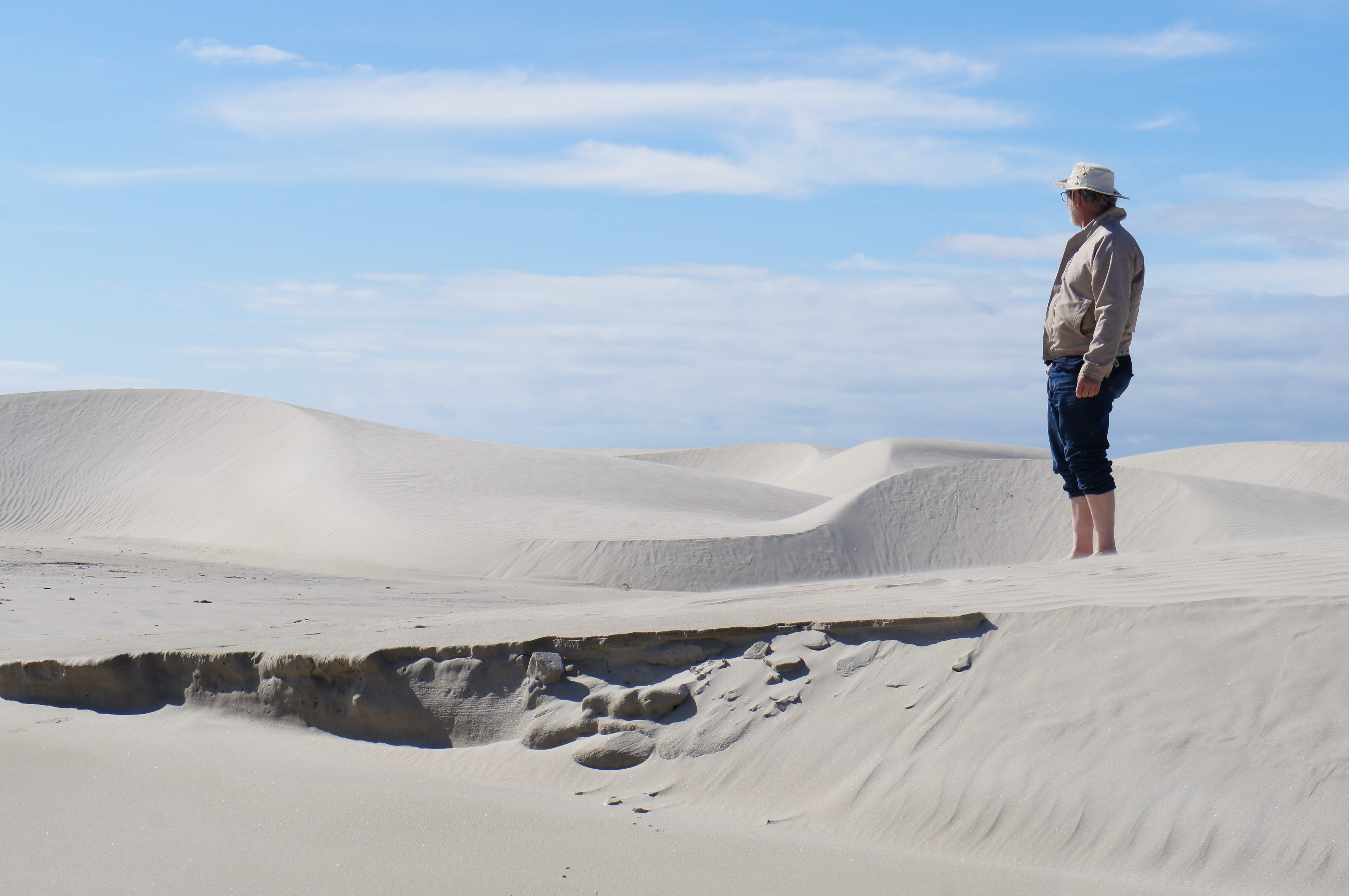
shore side of dunes at Prince Edward County Park
Vast expanses of sand in upstate NY and southern Ontario are generally not common and where they do occur, large inland deposits have more than a hint of mystery about them. Some of these barrens have remained unchanged for hundreds of years. In some locations where desert like barrens persist, people have made up stories about monstrous inhabitants, or sand origins including space alien influences.
And why do the lake’s few big sandy beaches persist? I had seen small patches of sand come and go on my cobble swim beach, but as I explored the lake with my boat, repeat visits to various locations along the lake’s coast suggested these sand shores were permanent. Were they man made? Did they wash out of some river? What kept them in the same place year after year? I don’t have a complete answer but read on.
In general the inland sand ‘barrens’ near the lake were formed during the last stage of the ice age when glacier melt water flows dropped acidic low fertility beds of quartz sand in deltas and shallow lake bottoms. After their deposit the drainage of these sands made them so arid that they were almost desert like. They are too dry to support forest growth and any trees that did manage to take root were susceptible to fire or wind storm blow downs. Too make matters worse for vegetation, sometimes winds shifted and moved the bare sand to form dunes that can bury small trees or uncover roots.
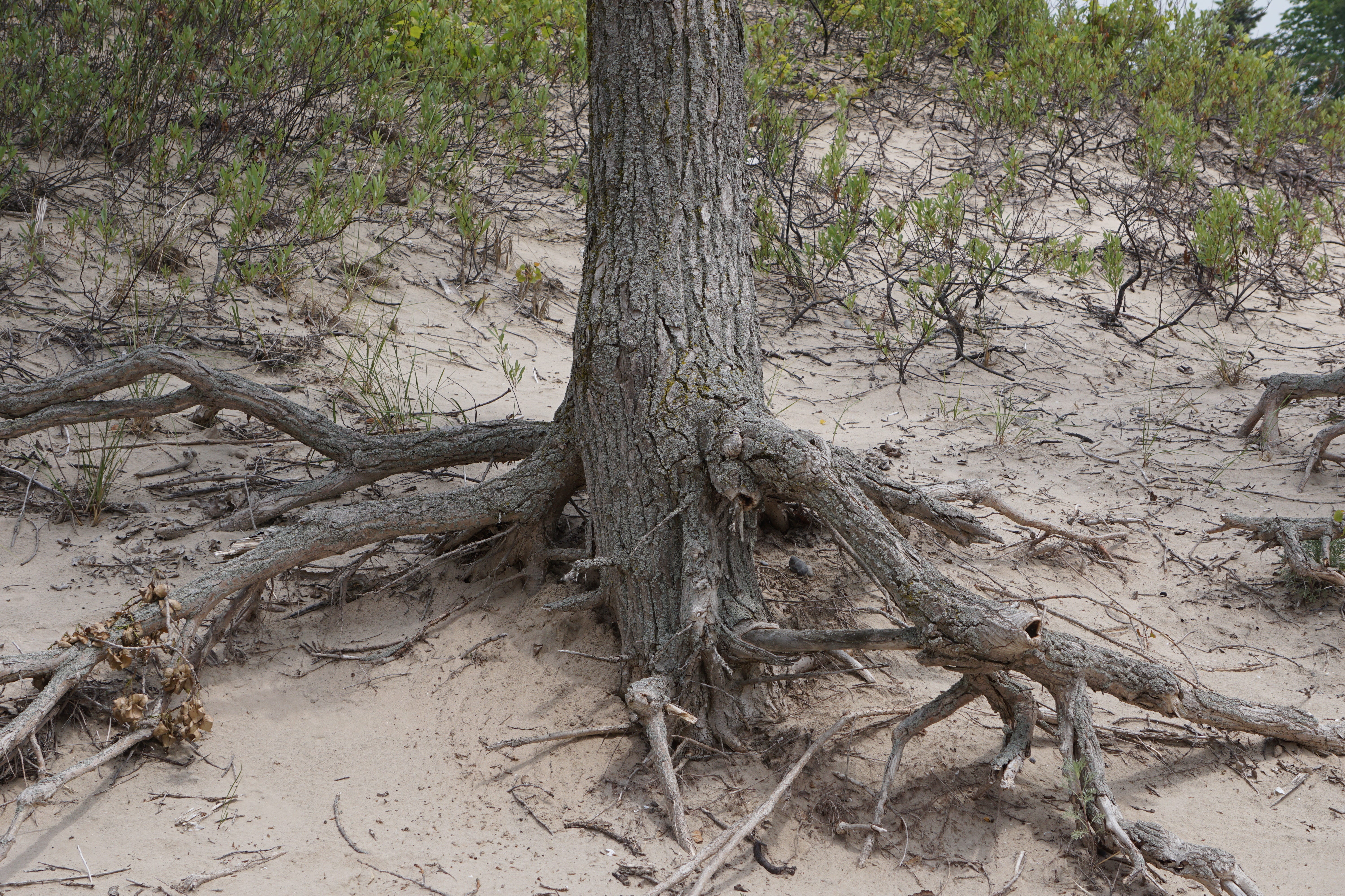
cottonwood tree roots
Compared to silt and clay, grains of sand are relatively heavy. It takes a goodly current to carry sand down a river, and since the ice age meltdown, most of the tributaries that now feed into the lake don’t have enough flow to contribute significant amounts of new sand to the system. So any sand beaches that are still around are generally not being added to except from shoreline erosion.
The biggest sand deposits are in Prince Edward County, Canada. The Sandbanks Park dunes cover about 1800 acres and have been called the world’s largest bay mouth barrier dune formation. The dunes formed from wind blown sand transported inland from the beach. The original sand presumably was left after the ice age melt down. According to a 1992 Management Plan for the park, there are some recent indications of reduced sand input at this location. There are also some smaller dunes at the east end of the lake in New York. The sandy beaches near Rochester likely originated from Genesee River deposits again during the glacial meltdown.
So what keeps the Prince Edward County sandbanks , the Toronto archipelago and the Mexico Bay/ eastern shore of the lake in place? Currents produced by wave action moving along shore presumably encounter some obstacle that slows transport causing the sand to drop out. Probably these different areas continue to be supplied with some sand from erosion, but most of the large stretches of beach are thought to be made of ‘fossil’ sand deposited during the ice age end onto the lake bottom.
photo below of Lake’s east end
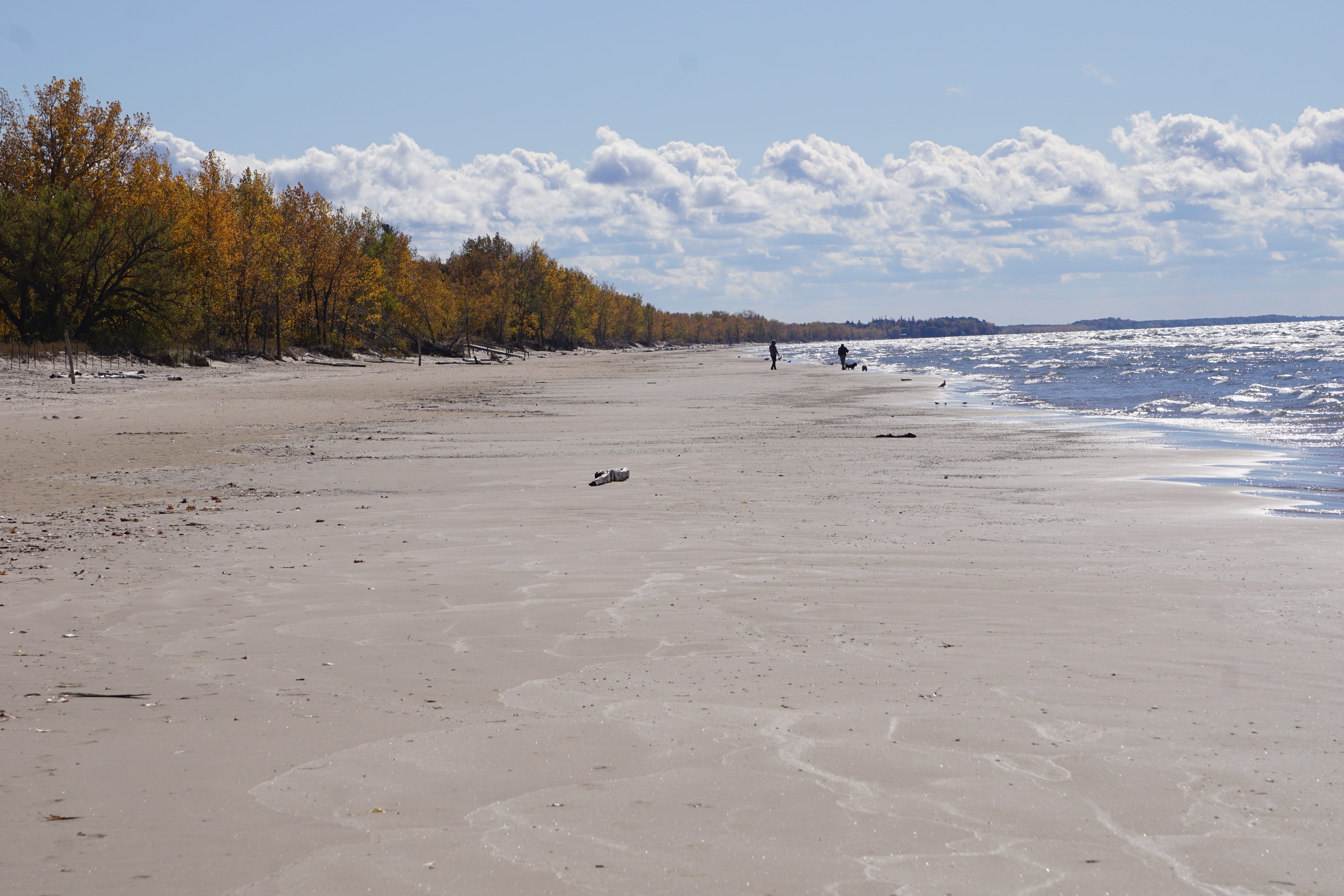
It’s thought the shoreline erosion of the big Scarboro Bluffs region just east of Toronto supplied the original sandy peninsula that protected the harbor back in the 1700s. At the east end of the lake where an extensive stretch of sand beach lies, literature from NY Sea Grant states the main source of sand was from “glacial deposits” presumably from both lake bottom and from glacial till on land.

Wave action moves sand onto and off the beach and also moves it down the channel between the jetties at Little Sodus Bay and at other locations on the south shore
Strong wave action can move sand from the lake’s near shore bottom on and off the beach. However, artificial hardening of the NY shore for residential development along with permanent navigation channels into the south shore bays that now act as ‘sediment sinks,’ have considerably reduced the transport of gravel, sand and silt sediment on to beaches. Some bays and marshes have lost their protective sand and gravel barrier bars. Since the last high water year in 2019 millions of dollars were spent to harden shorelines to protect waterfront real estate on the US side of the lake. This has left several bays and marshes without protecting barrier bars.
Photo of Blind Creek
Once this creek lost it’s protective bar and opened the gravel and sand began moving inward from the left as it became a “sand sink”
Recently one such lost bar at Blind Sodus Bay was “restored” by dumping rock and gravel from inland quarries to create a new barrier bar. The cost of this effort originally was estimated at 12 million US dollars. A subsequent bid came in at 13 million above that, giving, presumably, an estimated current cost of 25 million USD. That amount of money is a small fraction of what is spent to restore sand bars and beaches on the US salt water coast. Between 2018 and 2024 Congress had approved 770 million for emergency beach “nourishment” projects. The new sand generally is dredged from the sea bottom and deposited on the beach. Many of these pump and dump efforts only last a few years (or less) before another storm washes them away.
Here on Lake Ontario we may not know exactly where our sand originally came from. And we don’t know how long it will remain on our favorite beach. Only the sands of time will tell. Like water, sand, too, is restless stuff always on the move.
This article was adapted from a book in progress that deals with mysteries and marvels of our Great Lake
So much to know......fascinating.
I'm looking forward to your next book.